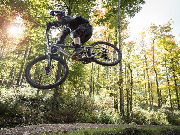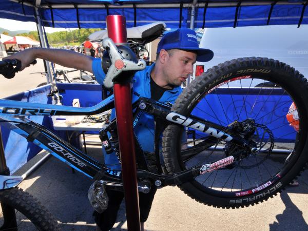
Bike Rentals + Repair Shops
Greene County's bike and repair shops provide a one-stop shop for anything you need, with passionate experts to help answer product questions and offer trail suggestions.
Catskills Road Cycling Routes
Start your Greene County road cycling with a visit to Nick Bove, owner and operator of Windham Mountain Outfitters, found near the ski resort at the junction of South Street and 296. Hunter Mountain Outfitters in Tannersville followed a decade later. Look for the owner—that's Bove. No sign of him? He's likely out on two wheels, pedaling the renowned climbs and scenic rural byways of the Great Northern Catskills.
"The sheer number of back roads gives us so much variety," says Nick Bove. "Every loop has so many variations, it seems like we have endless miles to explore."
Stop by, and Bove happily pulls out a county map to highlight cycling routes based on your desired mileage and effort. The outfitter doubles as aid station (buy a Clif Bar or Nuun hydration tablets here) and able pit crew, with mechanics ready for everything from a sidewall tear to bike fit issues. Swing by the Windham store on Thursday nights in summer for group rides: the A route typically runs 45 miles; B pedals 35, and C goes for a 20-mile jaunt.
Then come back the next week. Because in the Catskills, every turn feels brand new.

Take the “Scenic Loop”
Your Route: From Windham Mountain Outfitters, pedal north on Route 296 for .25, then turn west on Route 23. Warm up the legs on a gentle, 11-mile descent through farm country, and look left at the Batavia Kill for refreshing glimpses at riffles and waterfalls. When 23 runs into 23A, hang a left south. Stay on this road for 14 miles, climbing through Lexington toward Hunter along Schoharie Creek. At the 25-mile mark, head north on 296. The first of two 300-foot ascents arrives quickly. Carry momentum from the first descent into a steep grade that quickly eases up but climbs steadily over 1.5 miles.
"I come off that downhill and my speed drops right down," says WMO owner Nick Bove. "It happens so fast I wonder if I got a flat tire." Whir into Hendsonville and hang a left on 296 to return to Bove's shop.
Distance: 32 miles Elevation: 1,440 feet
Plan B: Prefer a gentler, quieter climb? Just east of Lexington, about 20 miles into the ride, turn north on Jewett Heights Road/County Road 17. Climb about 400 feet in three miles, then continue downhill on 17. This links up with 23 east of Windham to form a lollipop ride to Prattsville and back.

Get "Far Out" on This Route
Your Route: Leave town in the dust—turn north out of the Windham Mountain Outfitters lot, then west on Route 23. At the one-mile mark, take a right to cycle north on Mitchell Hollow Road/County Road 21. Downshift and keep your cadence up for a five-mile climb. Close to the top, merge with County Route 10 and cruise down into West Durham. At the T-junction, take Durham Road/County Route 20 west on a second ascent that tops out at 2,300 feet amid South Mountain State Forest. Don't miss a left turn onto Potter Mountain Road/County Route 3 at 11.5 miles. This turns into 990V and whisks cyclists down to Schoharie Reservoir. Pedal south on Prattsville Road/Route 39.
"It's stunningly beautiful—I feel like I'm on another planet back there," says WMO's Nick Bove.
Small hills dot the road along water's edge, but overall elevation falls until Prattsville. At 22.5 miles, turn left on Washington Street. This becomes County Route 10; five major climbs carry bikers up 1,000 feet over eight miles. Look past your handlebars to spot Windham Mountain across the river valley below. Watch for the right-hand turn onto 21—this closes the loop and returns to Windham.
Distance: 40 miles Elevation: 3,440 feet
Plan B: If legs feel heavy in Prattsville, continue past 10 to the junction of 23 and 23A. Follow 23 east for a gradual ascent that gains 400 feet over 11 miles on the return to Windham.

The “Ultimate Catskills Experience” Ride
Your Route: Want a crack at Devil's Kitchen, the test piece that makes pros dismount and walk? Pedal southeast from Windham Mountain Outfitters on Route 296; after a right in Hensonville, 296 drops southwest to Hunter. At 7.5 miles, continue on Route 23A past the ski area for the climb to Haines Falls. Next? A high-speed descent: 23A plummets 1,700 feet in 9 miles. Asphalt winds between a shale wall and a dramatic drop-off above North-South Lake—watch for drivers distracted by the view. At mile 19, get ready to duck right on Route 32A; turn south at Route 32; less than a mile later veer right onto Route 35. Savor the mellow approach, with consecutive rights on Blue Mountain Road and Van Buskirk Road. An uphill slope precedes a right turn on West Saugerties Road. Welcome to the Devil's Kitchen, a thin ribbon of tarmac that bolts up Platte Clove for a 1,280-foot gain in 2.2 miles; the grade tops out at 22 percent and averages 12 percent throughout.
"The right gear is your lowest gear," says WMO owner Nick Bove. "I switchback from side to side to keep my momentum up—doing that all the way up on a narrow road takes concentration and leaves you completely winded."
Your victory lap? Continue on 23A to 296 and Windham.
Distance: 46.5 miles Elevation: 4,100 feet
Plan B: Grab a bib for August's Tour of the Catskills. The 80-mile option includes 6,260 vertical feet and the Devil's Kitchen, where crowds line up to cheer racers to the top.